Morongo Band of Mission Indians
Cabazon, CA

Morongo Band of Mission Indians
Cabazon, CA
Client
County of Riverside
Location
Cabazon, CA
Typology
Planning | Master Planning | Transit Oriented Development
Services Provided
- Master Planning
- Site Planning
Facts
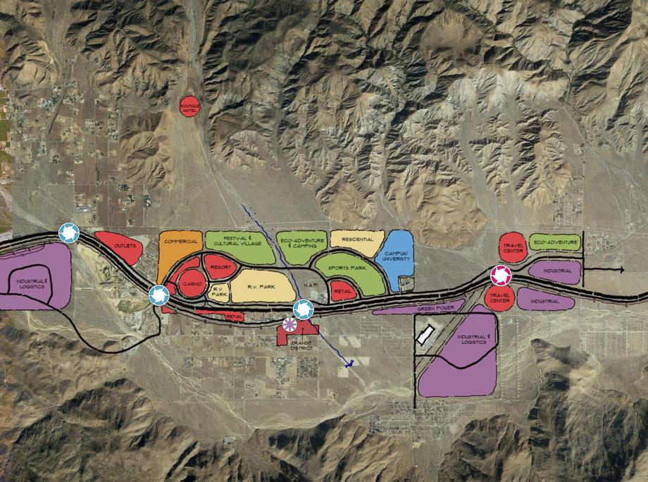
- Land Use: Residential, Manufacturing, Commercial, RV Park, Truck Stop, Multi - Modal Transit Station, Cultural | Festival Site, Open Space, Distribution Center, Warehouses, Logistics, Shooting Range
- Site Area: 3,600 ac
Story
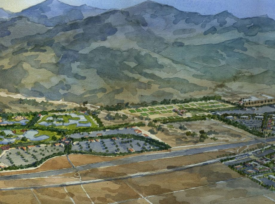
The Morongo Band of Mission Indians (MBMI) tribal land is located in Southern California, in the Banning pass between the San Gorgonio and San Jacinto mountains, approximately 15 minutes west of Palm Springs and 90 minutes east of Los Angeles. The Interstate 10 Freeway, one of the busiest highways in the United States, traverses the tribal lands and provides economic opportunity for the Tribe. The 3,600-acre master plan community delivers a variety of water activities adjacent to the Morongo casino encompassing a water park, campground and RV park, creating a hub of energy and engagement. The culture village provides a place for the Tribe to celebrate its heritage and display an extensive collection of artifacts including ollas, manos, metates and the Morongo basket collection. A newly planned festival site is dedicated to Pow Wows and tribal celebrations. Commercial and retail provides a different experience for outlet shoppers to dine, shop, play and gather. The land-use plan also creates a new travel center and truck stop at the northeast of the main street interchange. An indoor-outdoor shooting range is located at the foothill of San Gorgonio mountain. A trail system incorporated within the master plan community serves as one of the key placemaking elements connecting with the surrounding existing trail systems. Other placemaking sites, such as camping, RV parks and sports park create opportunities for different levels of social and recreational interactions.